Technology that delivers precision


Building on many years of expertise in the industry and with multiple licensed surveyors fully on board, HHLS meets your surveying needs in line with your schedule. Our range of service is diverse spanning major areas of hydrological and land surveying. In essence, we are able to meet most of your surveying services needs. Some of our core operational areas include:

  • Hydrographical Survey
  • LiDAR Survey
  • 3D Laser Scanning
  • Transportation Survey
  • Land Survey
  • Geospatial Asset Management

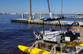
Hydrographic survey is the science of measurement and description of features which affect maritime navigation, marine construction, dredging, offshore oil exploration/offshore oil drilling and related activities.

HHLS provides bathymetry data that are used for flood control, dock and harbor engineering, water power, dredging projects, locating and mapping submerged obstructions, beach re-nourishment and monitoring, irrigation, sewage disposal, oil and gas exploration among others.

With our expertise and hydro equipment, we have the capability to provide single beam, multi-beam, side scan and sub bottom profiler data and maps with high resolution.

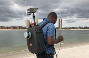
LiDAR is a remote sensing method used to examine the survey of the earth.

With our LiDAR backpack and all terrain LiDAR acquisition system, HHLS has the capability top produce quality map data that can be used for management of coastline, transportation planning, jetty monitoring, flood model, oil and gas exploration, view-shed analysis, sewer and manhole survey, tunnel surveying, railway infrastructure and beach survey.

Our final products processing software includes ArcGIS, Hypack, AutoCAD, MicroStation, Global mapper

With our 3D laser scanning services, whatever your eye sees can be measured to millimeter accuracy in only minutes. High-speed, non-contact 3D measurement devices collect – at lightning speed – high-resolution, panoramic images of the environment and objects near the scanner. Except these aren’t merely static images; these images hold spatial information that, in essence, digitizes the environment into CAD. This allows for precise measurements of even the smallest details, with accuracy to ¼ inch, and eliminates the need for survey crews to return to the site to pick up missed or more detailed data. The applications for 3D laser scanning are numerous, and include as-built documentation, industrial plant maintenance, volume calculations, ALTA, bridges and tunnels, retrofit and rehabilitation projects, new equipment installations, and manufacturing and process inspections.

HHLS offers three different 3D scanning technologies: pulse (time of flight or TOF), phase-based (PB) and mobile scanning. TOF scanners utilize a “pulse” of laser light. This pulse is sent to the object and the time is measured from when it was emitted to the time it returns. The time and the encoder reference angles and then compute an x, y, z point, along with a reflectance value. TOF scanners are mainly used for long-range (100m +) measurement applications like topographic surveys.

PB scanners employ a “continuous wave” of laser light that is emitted at varying frequencies in a steady stream vs. a pulse. The different frequencies help the scanner cover different distances; a low frequency travels long distances and short frequencies serve well for close range, very similar to sound waves. The scanner receives the return waves and measures the “phase-shift” of the wave compared to when it returned. This shift calculates the distance from the scanner and, along with encoder references and inclinometer, calculates an x, y, and z value along with reflectance.

The main differences between PB and TOF systems are speed and range. Phase-based scanners are primarily used for indoor or piping scans (< 50m) where detailed scans are needed; scans are typically 3.5 minutes long.

LAND, RAIL and WATER

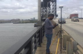
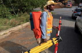
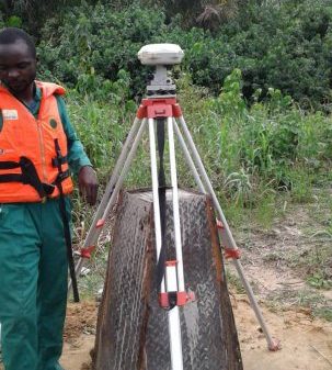
With our professionals and technological equipment’s like Total station,RTK GPS, LiDAR, Sonar. HHLS have the capability to provide data that will help engineers in design and maintenance of land, rail and water transportation system.

The service we provide include initial survey from design, setting-out  and as-built survey of a completed project.

HHLS land surveying professionals can quickly and accurately collect, process and plot the specific data necessary to make your project a success. From electric transmission and distribution to pipelines and highways, we help our clients plan, build and maintain critical and sustainable infrastructure.

MAINTAIN ACCURATE AND ACCESSIBLE DATA ASSETS

HHLS OFFERS STATE-OF-THE-ART DATA COLLECTION METHODS AND SOLUTIONS THAT PROVIDE ACCESSIBLE DATA TO MEET SPECIFIC REQUIREMENTS THAT HELP OWNERS MEET THEIR OBJECTIVES.

Geospatial asset management and asset management solutions help energy providers, transportation officials, municipalities, business owners and governments optimize the locational intelligence derived from geospatial data. By compiling, organizing and maintaining valuable data information, geospatial asset management can help businesses and municipalities respond expediently to emergency situations like power outages, burst water mains and ruptured utility lines during construction or vehicle crashes. Geospatial asset management helps companies and organizations function more efficiently during non-emergency situations, too. Geospatial data that is accurate and readily accessible helps businesses respond more effectively to customer inquiries, locate maps and other documentation, and schedule and implement routine infrastructure maintenance and upkeep.

HHLS offers state-of-the-art data collection methods and solutions that provide accessible data and result in effective geospatial asset management. From our toolbox of data collection technologies, HHLS can select and employ the most appropriate data collection method— such as airborne and mobile LiDAR, terrestrial scanning and GPS—for your particular project. We can geo-reference the data and assign attributes. Then, using customized algorithms and routines, HHLS can return your data to you in an accessible, virtual-world format that doesn’t require massive computer storage. In this way, HHLS  creates truly useful and effective geospatial asset management solutions.